Portaikos Folds
Address
Pyli 420 32
GPS
39.457081752378, 21.596566926291
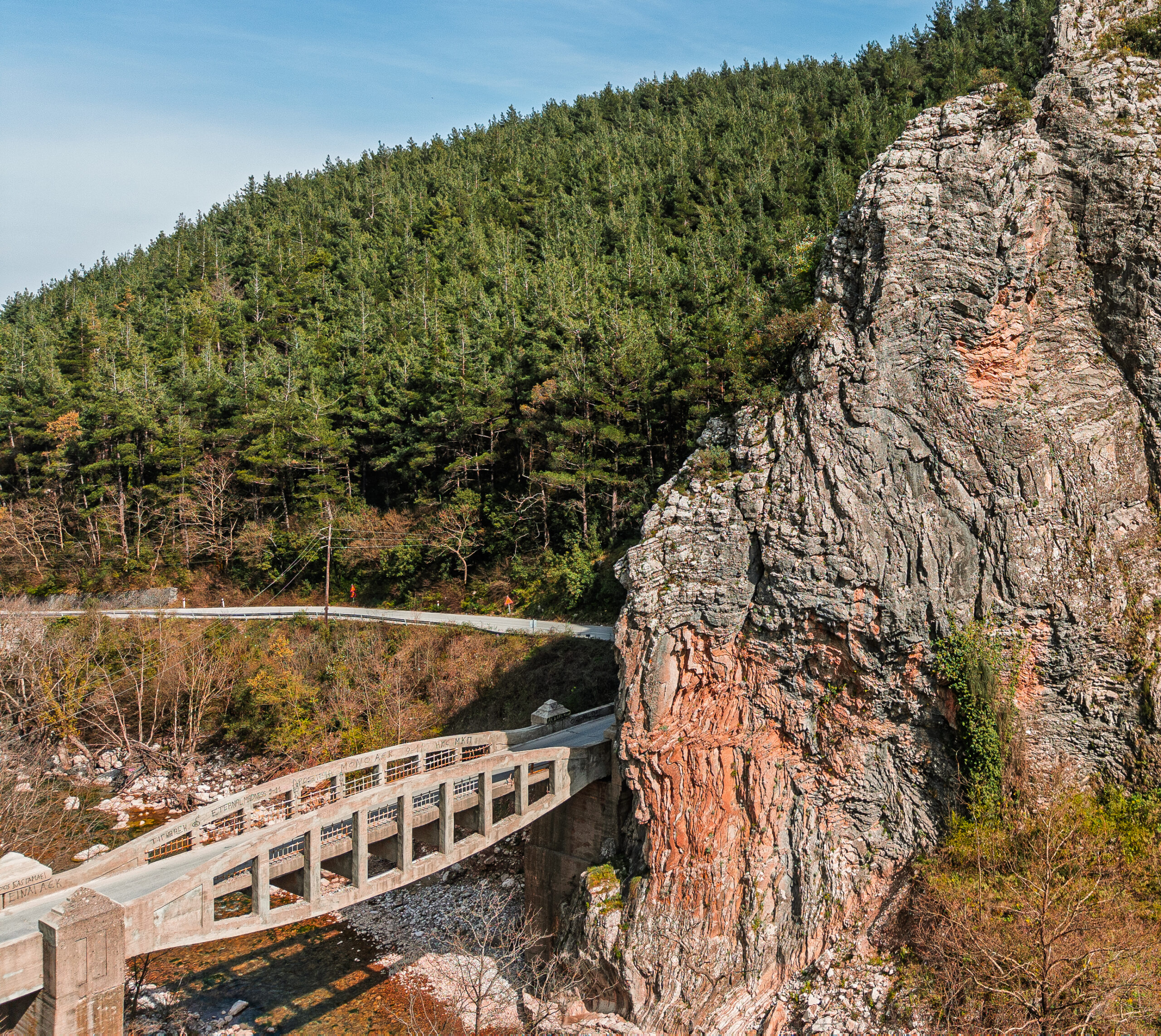
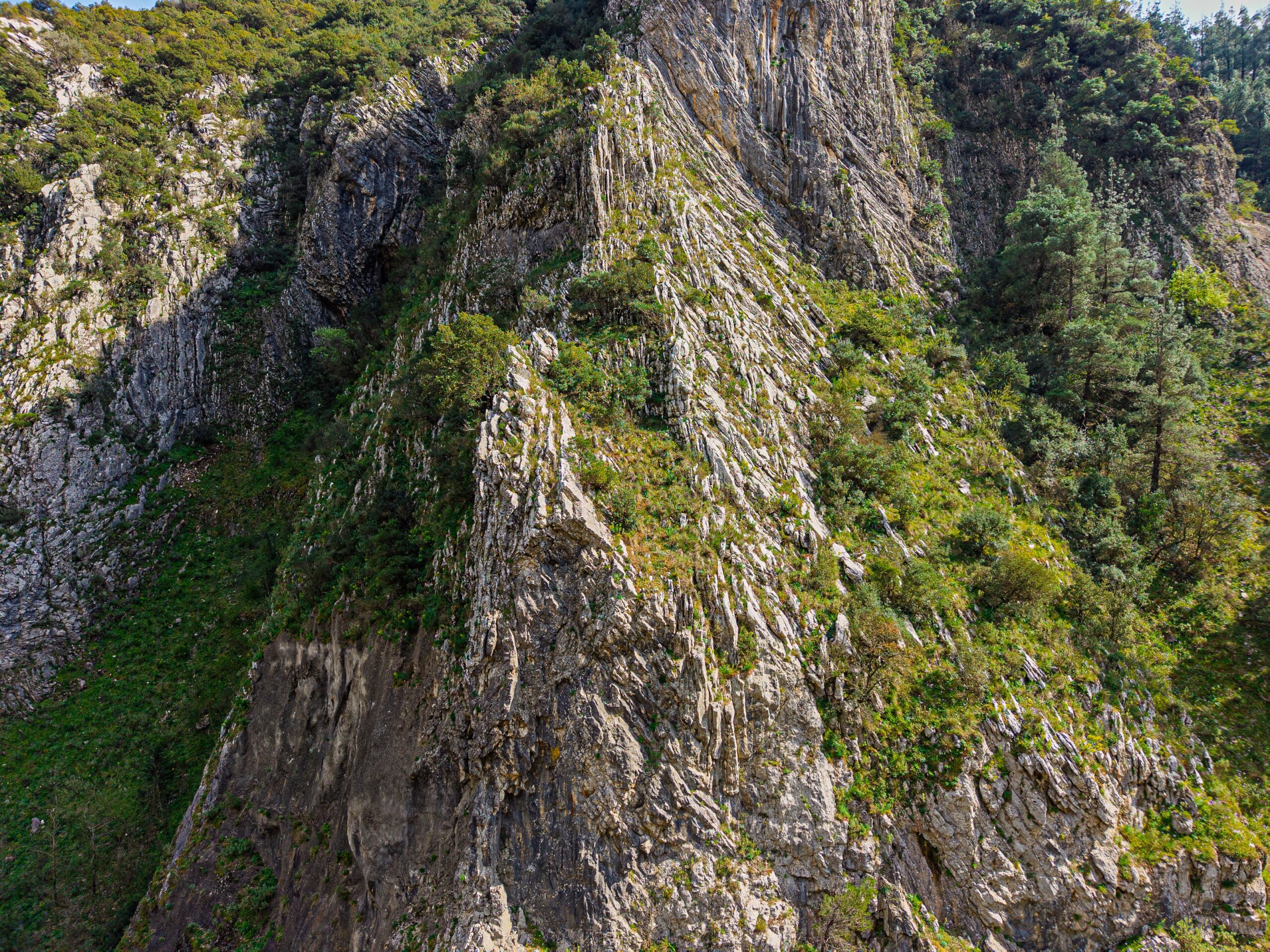
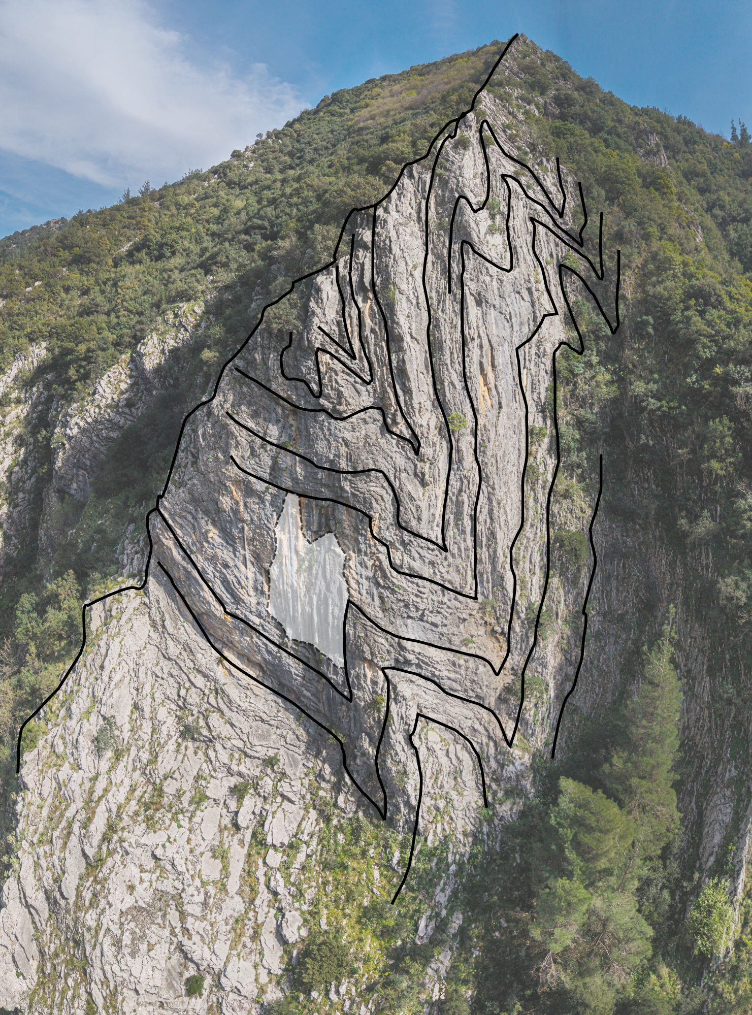
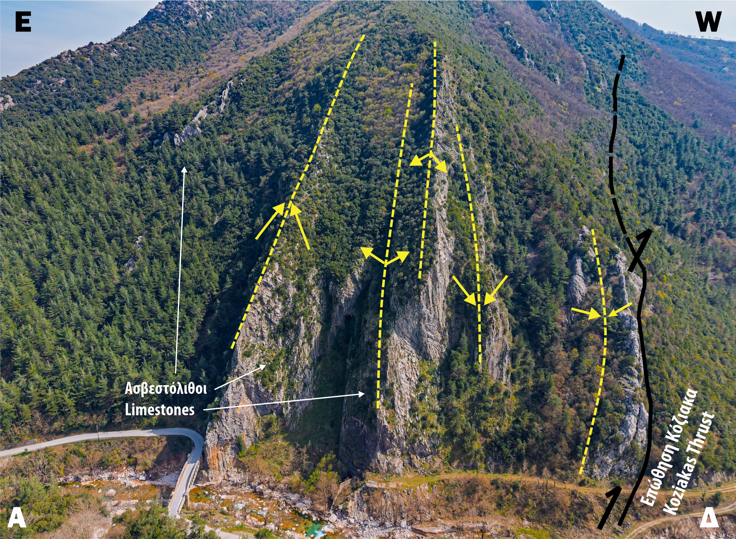
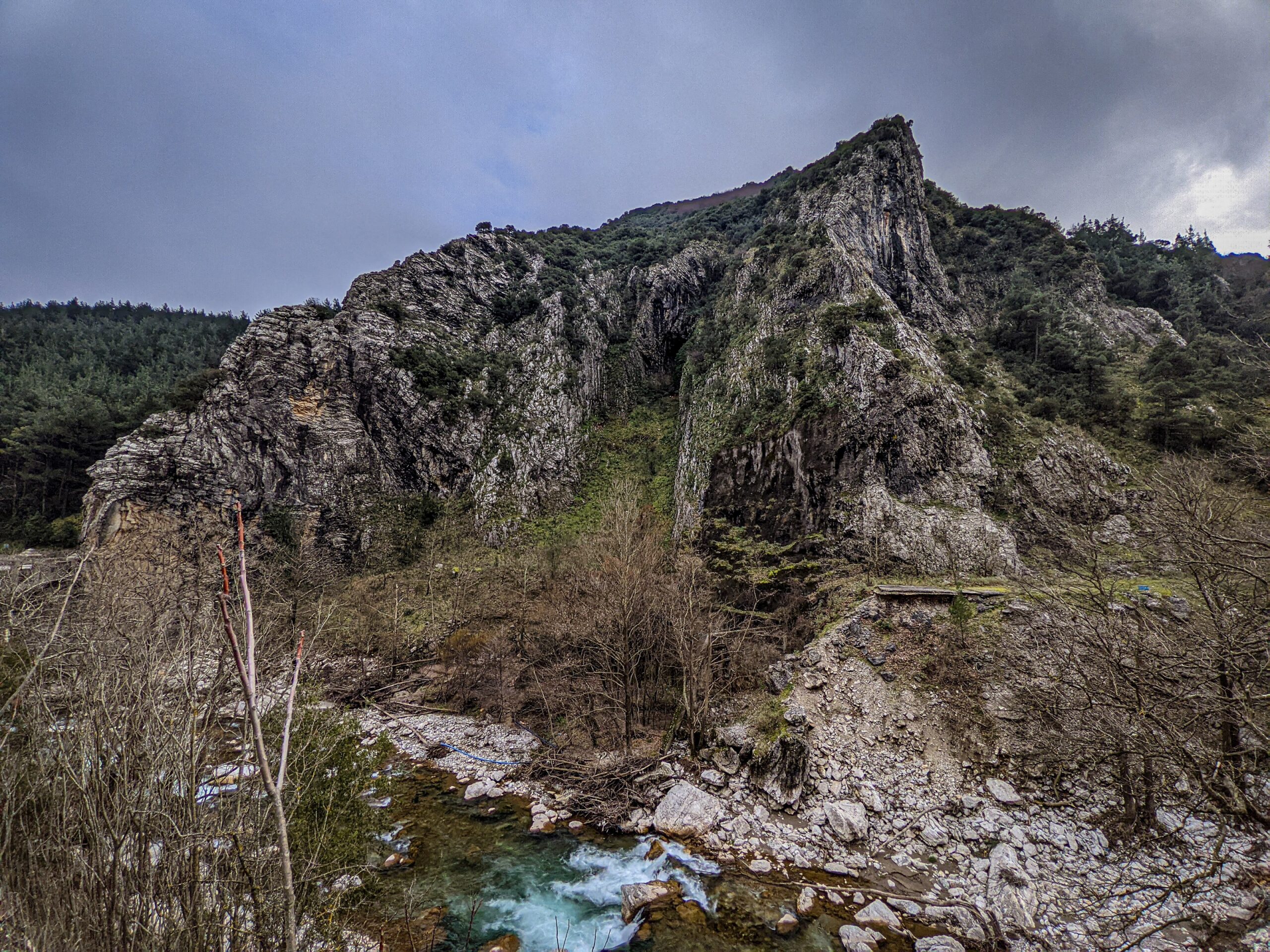
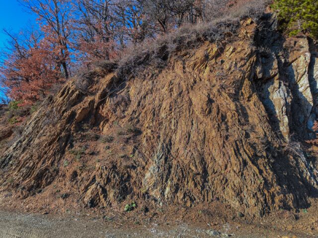
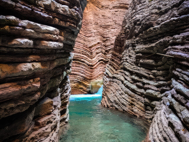
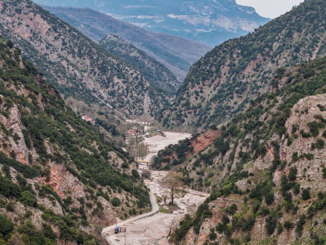
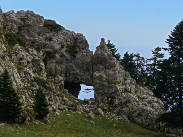
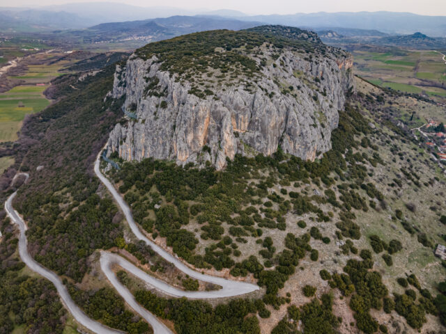
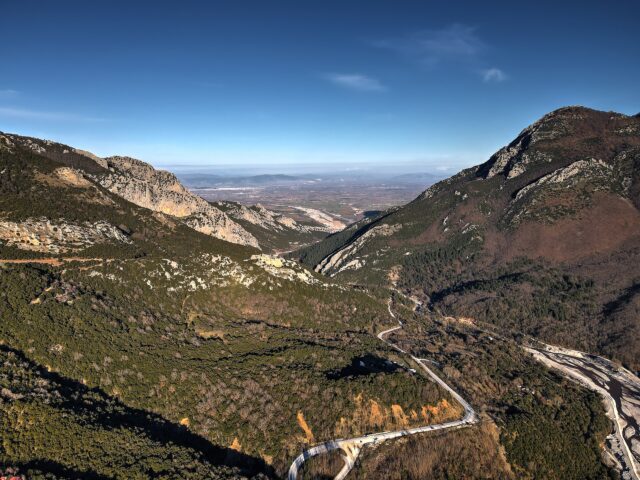
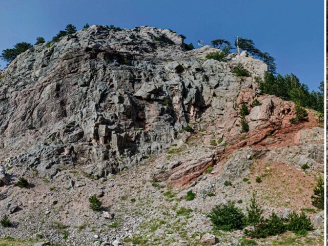
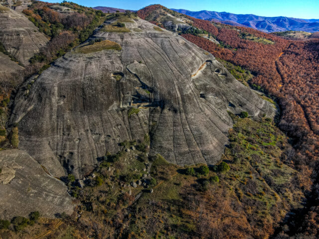
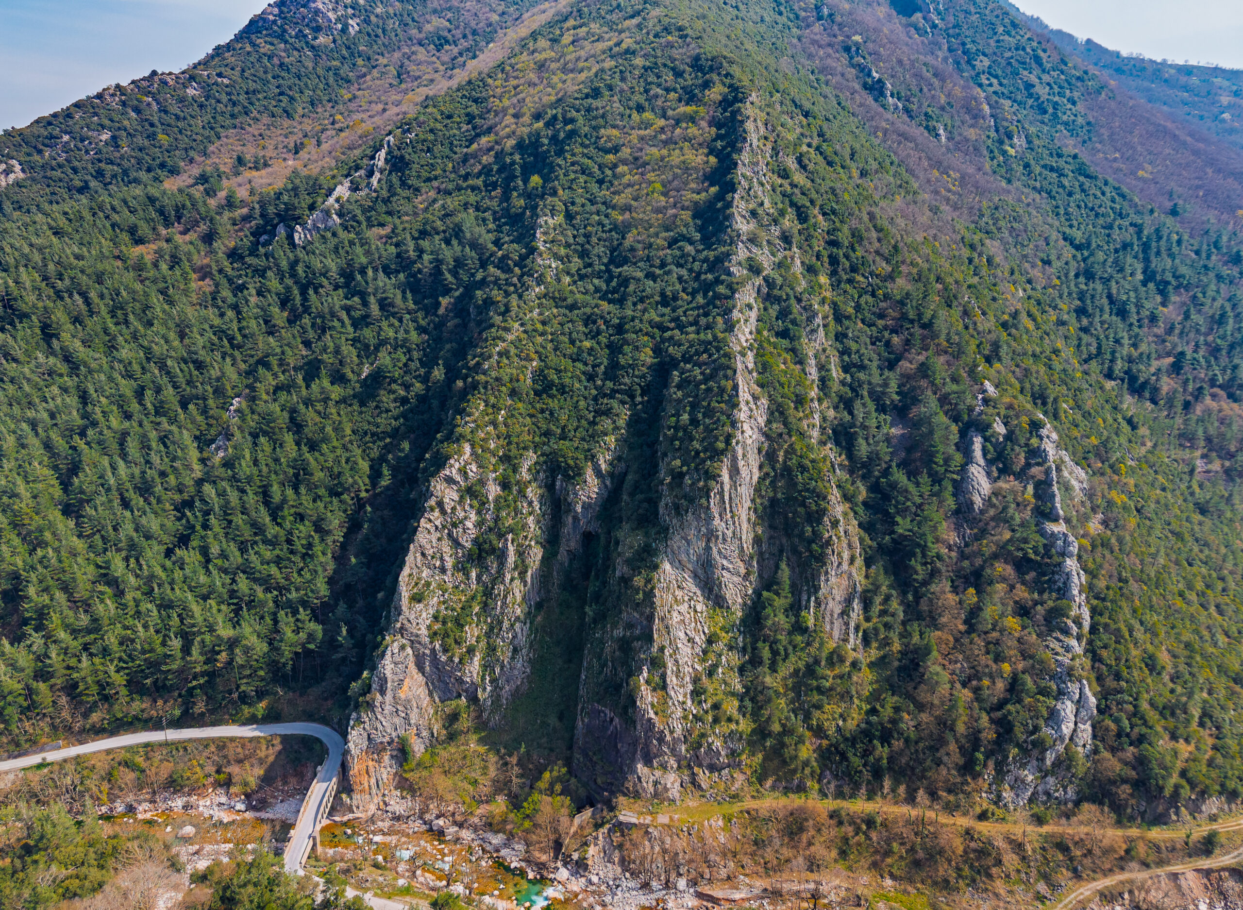
In the Portaikos area there are impressive folds of rocks composed of multi-colored formations. These are created due to the folding of geological formations due to the compressive forces exerted on them, forming impressive tectonic structures. In the area, red hornblende/radiolarites appear within the limestone rocks, which are created at great depths in the oceans. Folds can be observed in the rocks above Porta Panagia in Pyli, and on the steep slopes of the Portaikos valley. After the stone bridge of Agios Bessarion, the valley narrows and at the location of the Portaikos bridge we can see on the south side impressive folds in the limestone rocks of Koziakas. These are isoclinic folds in the limestone layers, which in turn are placed almost vertically due to the Koziakas thrust that is exposed at the end of the gorge.
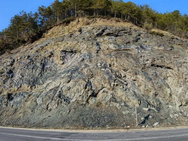
The Koziakas geotectonic unit, together with ophiolitic rocks, is tectonically placed towards the west over the Tertiary flysch of the Pindos zone, with a characteristic surface of compressional movement, creating the Koziakas thrust. The Koziakas tectonic thrust is indicative of the direction of compression during the final stage of the Alpine orogenesis and emergence of the Greek mountain ranges. In the eastern part of the Koziakas mountain range, the thrusting of ophiolitic mixtures and a large mass of ophiolitic rocks originating from the Subpelagonic Zone, which is located a little further east, onto the rocks of the Koziakas tectonic unit is observed in places. The compression of the formations causes folding on a large (hundreds of meters to kilometers) but also on a small scale of a few meters. Most of the folds are directed westward, following the direction of thrusting of the Koziakas onto the rocks of the Pindos zone.